


seminars
10
Jul
2026
26
Feb
2027
Earth System Physics
Current Weather - Fridays 14:30 CET
Hybrid
Back
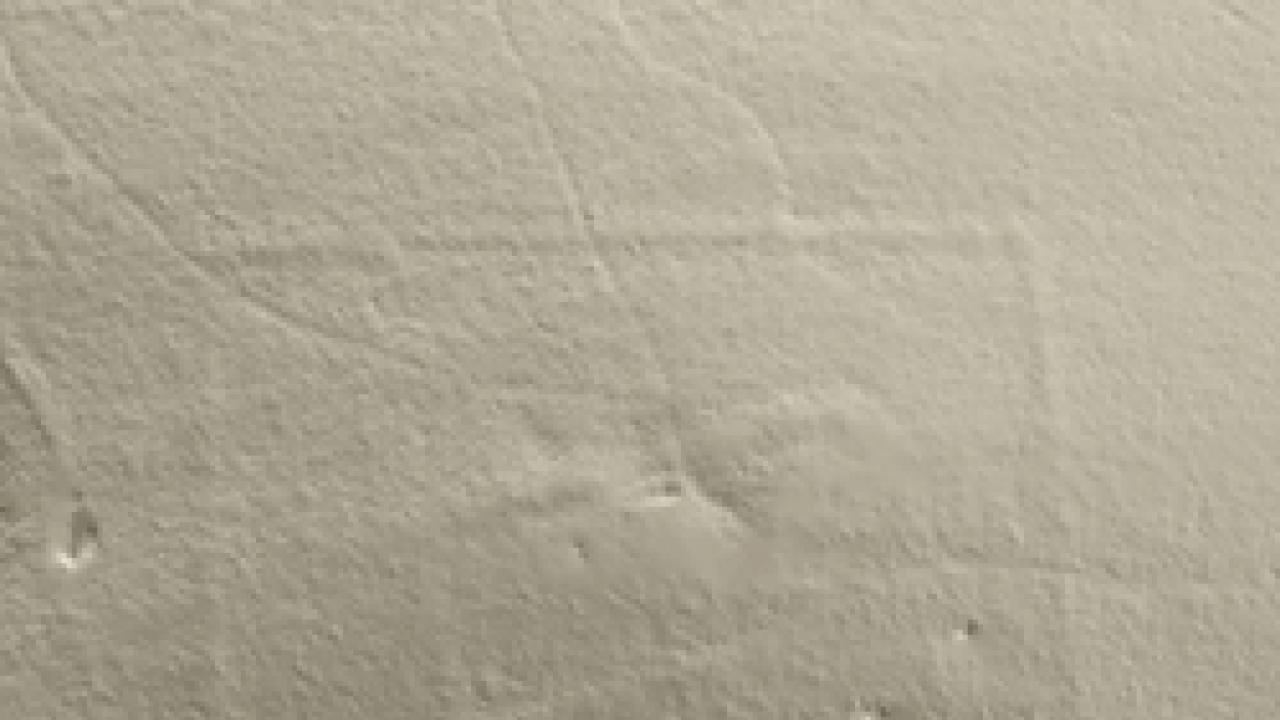
A team of scientists from ICTP's Multidisciplinary Laboratory
have discovered the probable remains of a Roman fort in an area of
north-eastern Italy unknown to contain such structures.
The discovery was unearthed not by traditional archaeological
excavation methods but by analysing images produced by Airborne
Light Detection And Ranging (LIDAR).
LIDAR uses laser light to remotely sense the properties of
objects. In the case of the ICTP research, the "objects" were a
series of archaeological sites in the Trieste Karst, a region
northeast of the Adriatic Sea.
ICTP scientists Federico Bernardini and Claudio Tuniz produced a
digital terrain model from the LIDAR images, which revealed a
number of unknown fortified structures. Among those is a
rectangular area of about 165 by 134 meters containing a second,
inner wall, suggesting the remains of a Roman military fort, a
structure almost completely unknown in the studied area, according
to the researchers.
The fort could be related to Roman military activities in the
Adriatic area during the third Istrian war (178-177 a.C.), the
researchers speculate, although they call for further
archaeological investigations before drawing any firm conclusions
about the role of the site.
Results of the analysis will be published in the Journal of
Archaeological Science. The work is part of the ICTP/Elettra
EXACT Project (Elemental X-ray Analysis and computed Tomography)
funded by Regione Friuli - Venezia Giulia (Italy), and was done
with cooperation from Ispettorato agricoltura e foreste di
Gorizia e Trieste, the University of Trieste and other
institutions.